next: Life/People
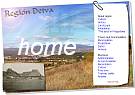
| Landscape |
Detva lies in the eastern part of the Zvolen depression on the banks of
the Slatina River in the Detva depression. The most dominant feature of
the region is the strato-volcano Polana which is the highest extinct
volcano in mid-Europe (1,458 meters above sea level). The countryside
is distinct for its unusual natural heritage. Unique ecosystems,
important parts of biotic nature, and the unique formations of the
country led UNESCO to list this territory (Polana, 20,079 ha.) as a
preserved country area under the network of the UNESCO world biosphere
reservations.
The features of flora and fauna are determined by their existing in the area of the Western Carpathians with its varied geological and geomorphological development. The highest point of the Detva region lies 1200 m above sea level and the lowest is 370 m. Rock cliffs, which are a memento of lava flows, or of created lateral craters, diversify the country beneath Polana. Polana's mountainous country in its southern part ascends into the Detva mountain, with its less dissected and smoother relief. Small differences in attitude/altitude cause that climate to be only slightly differentiated and is overall characterized as mild to warm with big inversions of temperature, mildly dry up to damp. Average temperatures in the coldest month of the year, January, are -4 up to -5 degrees Celsius, and in the warmest month, July, 16 up to 18 degrees Celsius. The average number of summer days is 50 up to 60; the days without frost are 120-160. Snow cover stays for about 100-120 days a year. Crater of the mountain massif Polana BYSTRO WATERFALL - volcanic stone wall, approximately 23m high, on the southern slope of Polana, under the Priehybina seat where Bystry potok flows down and creates the waterfall KALAMARKA- typical andesite rock platform (created by the volcanic activity of Polana), circled with stone walls, chimneys and towers with heights exceeding 10 m; situated approximately 5 km north from the centre of Detva, an interesting place for mountain climbers, MELICH'S ROCK - stone column formation, the tower-shaped remains of volcanic activity; situated on the southern toe of Polana, above Skliarovo village (Detva) JANOSIK'S ROCK - huge agglomerate stone cliff, 30 m high, with a small cave in the middle, created by slaching approximately 5 km from the village of Hrochot VEPOR ROCKS - numerous stone tuff columns and towers 30 –35 m high in meadows; accessible from the village of Lubietova MICINA TRAVERTINE - maintained natural source system of mineral water in the environment of ten strangely shaped travertine mounds. Deposited rocks create a cascade of small terraces and ponds with little waterfalls. They are close to the main road from Dolna Micina - Cerin. Preserved area - MEANDERS OF KAMENISTY POTOK - 2.5 km of the upper part in the area of Sihla village |
next: Life/People